
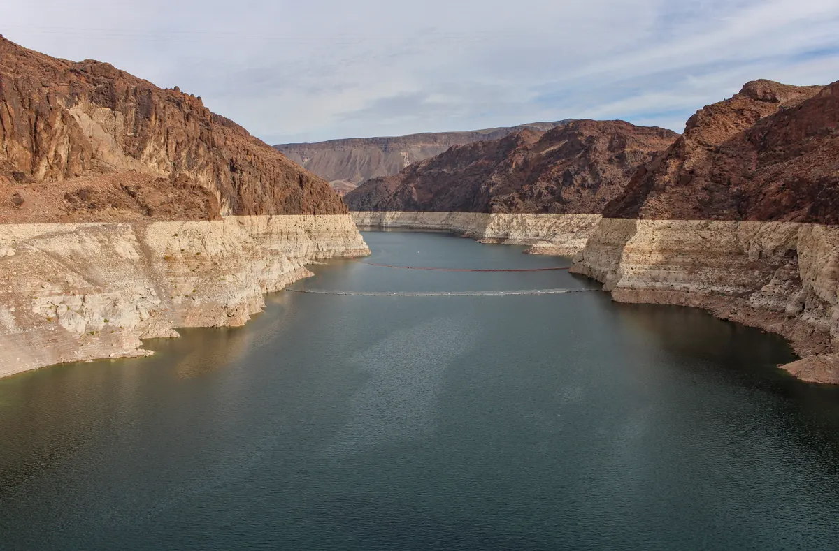

Lake Mead water levels on 4 August 2026 stood at 1,040.81 feet above sea level, less than four inches above the reservoir’s historic low recorded in July 2022, raising fresh safety concerns for the thousands of boaters who visit the National Park Service (NPS) site each year alongside broader alarm over water and energy supplies for millions of people across the south-western United States.
How Low Can Lake Mead Go?
The drop is steep when set against recent years. On the same date in 2025, the level stood at 1,045.19 feet; on 4 August 2024 it was 1,061.44 feet. According to the Pagosa Daily Post, water has not been this low since April 1937, when the reservoir was still filling, scarcely a year after crews completed work on the 726-foot-high Hoover Dam. That puts current conditions in a bracket not seen since the reservoir’s earliest days of operation.
The wider Colorado River system is under equal strain. The Pagosa Daily Post also reports that combined storage across Lake Mead and Lake Powell, the large pool sitting upstream of the Grand Canyon, is at an all-time low. That double-reservoir picture matters because the two bodies together act as the primary buffer for the entire Colorado River Basin’s water demands.
The structural cause runs deeper than a single dry season. The Colorado River once flowed at least 15 million acre-feet a year but now averages closer to 12 million acre-feet in this century, according to the Pagosa Daily Post, a sustained reduction that has progressively eroded storage across the system. Heavy water usage compounds the effect of persistent drought.
The Department of the Interior‘s Weekly Hydrologic Update puts Lake Mead’s current storage at roughly 27% of its historic capacity, with the shoreline having receded by more than 188 feet. At its present trajectory, the reservoir is approaching what specialists refer to as “dead pool” status, defined as the point at which water can no longer flow freely through the dam to generate electricity, currently set at 895 feet above sea level.
The stakes are considerable. Lake Mead supplies water to approximately 25 million people across Arizona, California, Mexico, and Nevada, and provides power to around 1.3 million people. The ghost town of St. Thomas, founded in 1865 and submerged after the Hoover Dam flooded the valley in the 1930s, has already re-emerged from the receding waters, a visible marker of how far levels have fallen.
Submerged Rock Spires and Mesa Tops Now a Boating Risk
Lake Mead is a reservoir rather than a natural lake, formed when the Hoover Dam backed up the Colorado River. It was first flooded on 30 September 1935. Because it inundated an existing mountain landscape, its bed holds an irregular terrain of buttes, rock spires and mesa tops rather than a flat lakebed. As lake Mead water levels fall further, those features are moving closer to, or breaking through, the surface.
Chief Ranger Mike Garel told KVVU-TV that the site ‘doesn’t have typical lake topography. It’s a flooded mountain range, so it does have some of those hazards that are below the shore.’ Garel added: ‘Obstacles are not just close to shore. There’s also submerged rock spires and mesa tops, stuff that’s along the original Colorado River Valley.’
NPS rangers are marking known hazards with buoys and continuing to patrol the area. Garel noted that in the narrows in particular, buoys are being placed directly above hazard rocks sitting just below the surface. The pace at which new features emerge, however, means buoy coverage cannot be guaranteed to keep up.
Lake Mead is already the deadliest NPS site in the United States. According to a Valiente Mott report, 317 deaths were recorded at the recreation area between 2007 and 2024, with drowning accounting for 110 of those fatalities and motor vehicle crashes a further 66.
The NPS is now advising boaters to carry nautical maps and a marine radio or satellite phone at all times. When entering unfamiliar areas, the use of spotters to scan ahead for hazards is recommended. Anyone who encounters a previously unknown obstruction is asked to report it, along with their coordinates, to lake_information@nps.gov so it can be added to official charts. As lake Mead water levels continue to fall, the number of such reports is expected to grow.
