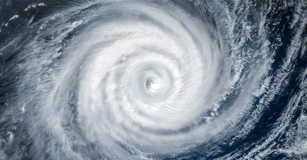
Hurricane Helene has struck Florida’s Gulf Coast with unprecedented intensity, reeling under winds reaching 140 mph. Initial reports caution against impending severe conditions across the southeastern United States. Experts urge vigilance amidst the unfolding weather crisis.
The US National Hurricane Centre has categorised Helene as a category four hurricane, signalling an ‘extremely dangerous’ threat that is likely to affect millions. As Helene moves inland, residents are advised to take necessary precautions to stay safe.
Impact on Florida’s Gulf Coast
Hurricane Helene barrelled into Florida’s Gulf Coast, exhibiting winds of up to 140 mph. This formidable force classified it as a category four hurricane, as per the US National Hurricane Centre (NHC). The Big Bend region bore the brunt of Helene’s wrath as it intensified while navigating the Gulf of Mexico. Experts have sounded alarms about the hurricane’s potential to deliver fierce, destructive winds across the southeastern United States.
As the tempest progresses, it is anticipated to veer northwestward towards Georgia, with a deceleration expected over the Tennessee Valley by Friday and Saturday, according to the NHC. The gravity of the situation is magnified by the sheer number of people—over 30 million—across the southeastern U.S. who have been alerted to the looming threats of flooding and tornadoes.
Widespread Storm Conditions
Reports indicate that southern and central Florida are experiencing tropical storm conditions, with the storm’s reach expanding northward through the tropical storm warning zones. Powerful gusts are likely to penetrate inland, as far as the formidable terrain of the southern Appalachians, compounding the storm’s already extensive impact.
With predictions estimating total rainfall accumulations of six to 12 inches, with some isolated areas receiving up to 20 inches, the NHC has underscored the likelihood of catastrophic and life-threatening flash and urban flooding. Anticipated is significant river swelling and many consequential landslides in the steep terrains across the southern Appalachians.
State Response and Preparations
Florida’s Governor Ron DeSantis has issued a stark warning to residents, urging them to “hunker down” and eschew travel on roadways due to potential dangers. The hurricane has already claimed a life, following an incident involving a fallen sign on a highway in the Tampa region, underscoring the storm’s lethal potential.
With the dawn, residents are bracing themselves for what might be a grim reality on waking: more loss of life and considerable property damage. The experience from previous hurricanes underscores the necessity of adhering to safety advisories and staying off the roads.
Projections for Hurricane Helene’s Movement
Forecasters predict that Hurricane Helene will continue its trajectory northwestward, its speed diminishing over the Tennessee Valley area. Meteorologists are cautiously observing the storm’s path, recognising the potential for it to cause further devastation as it moves through the southeastern United States.
The expectation of further heavy rainfall and strong winds necessitates continued vigilance from those in its path. Such conditions significantly increase the risks of landslides and flooding, especially in geologically sensitive areas.
Residents in the projected path are advised to secure properties and prepare emergency kits. Local authorities are working diligently to provide up-to-the-minute information and resources to ensure community safety.
Aftermath and Community Impacts
As the hurricane progresses, its aftermath is likely to include extensive infrastructural damage and potentially prolonged disruptions to daily life. Communities will need to galvanise efforts to support those affected, with emergency services playing a crucial role in recovery and response.
Rebuilding and recovery in the wake of such a potent storm demand collaboration at all levels—governmental, community-based, and individual. The focus will be on restoring stability and providing essential resources to those in need, while also addressing long-term preventative measures.
The frequency and intensity of recent hurricanes have sparked conversations about climate change and the need for adaptive measures to mitigate future impacts.
Simultaneous Weather Events
Meanwhile, across the continent, Mexico’s Pacific southwest coast is contending with Tropical Depression John. It is expected to escalate into a category one hurricane as it makes landfall, adding to the complexity of managing simultaneous severe weather events in the region.
The dual challenge presented by both Hurricane Helene and Tropical Depression John underscores the need for robust emergency planning and international cooperation in weather-related crises.
These concurrent events highlight the pressing need for global strategies aimed at mitigating the effects of increasingly volatile weather patterns.
Expert Opinions on Preparedness
Experts stress the importance of advanced preparedness and adequate response strategies to handle hurricanes of such magnitude. Continuous investment in infrastructure and community education can significantly enhance resilience against such natural disasters.
Moreover, fostering robust communication channels between authorities and the public is critical to ensuring timely dissemination of information and guidance during crises.
As Hurricane Helene continues its devastating path, the prevailing sentiment underscores the gravity of the situation. Communities brace for aftermaths that include potential loss and long-term recovery efforts.
It remains imperative that both local authorities and residents maintain vigilance and cooperate to ensure safety. This event serves as a reminder of nature’s unpredictable force and the necessity for preparedness.

